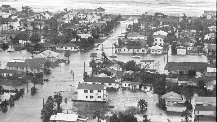
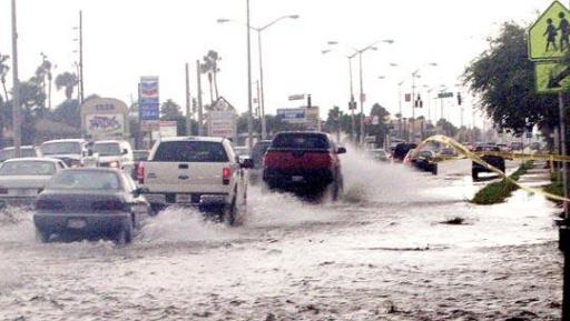
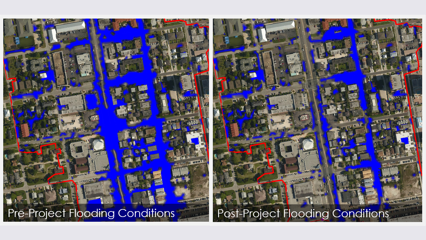
For more than 20 years, the City of Jacksonville Beach has experienced serious seasonal flooding along A1A and surrounding streets. As part of a larger team contracted with the FDOT District 2, SAI was responsible for developing a highly detailed stormwater model of a 3.7-square mile area of the City to evaluate the existing flooding condition and develop and optimize various flood mitigation designs. In the area of concern, SR A1A was constructed in a depression between relic sand dunes and the Atlantic Ocean. That fact coupled with an inadequate drainage system results in frequent flooding along this highly trafficked roadway.
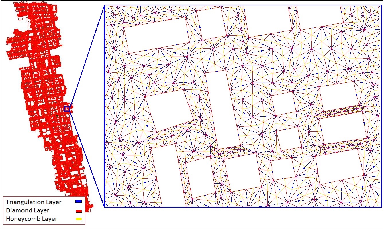
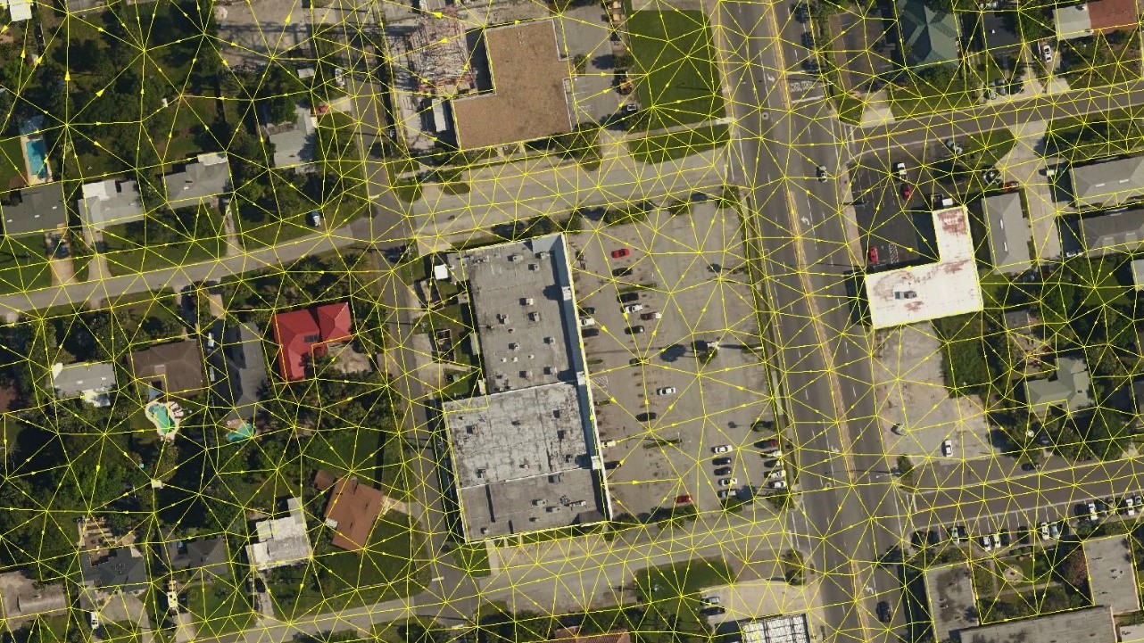
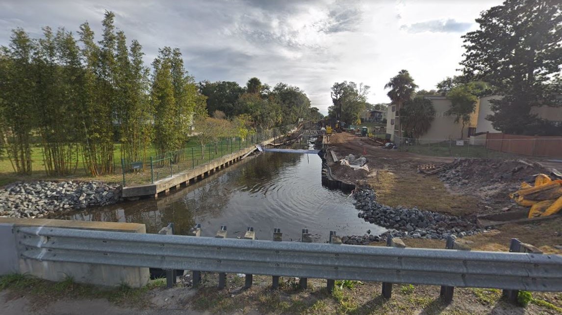
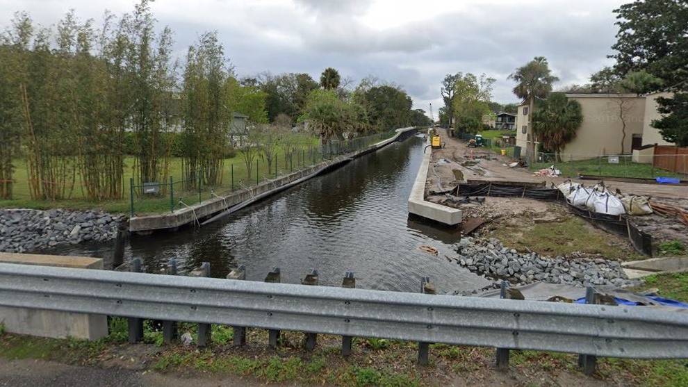
SAI originally updated an existing ICPRv3 model to validate the flooding condition and conduct expedited alternatives analyses. However, to better represent the overland flow (as much of the flood flow in the area is characterized), SAI developed a more complex ICPRv4 model that included triangulated 2-D mesh elements with over 22,800 nodes and 65,200 links. This allowed SAI to more accurately represent overland flow and evaluate the designs using animations of flow, flood depth, and flood profiles. In collaboration with the design efforts of the project team, SAI used these model tools to evaluate and optimize approximately 400 design scenarios. These included new intercoastal outfalls, upsizing existing drainage infrastructure, channel regrading, pumping systems, and maintenance improvements. The final design includes replacement of the Kings Road Bridge and regrading and widening the channel. The design also includes the installation of sheet pile wall in the outfall channel and the replacement of the roadway crossings at 4 roads.